


AMARGOSA VALLEY PRECINCT 06, Nye County, Nevada
About
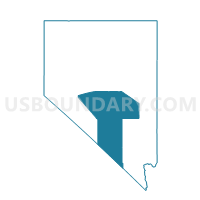
Outline

Summary
| Unique Area Identifier | 615424 |
| Name | AMARGOSA VALLEY PRECINCT 06 |
| County | Nye County |
| State | Nevada |
| Area (square miles) | 589.94 |
| Land Area (square miles) | 589.86 |
| Water Area (square miles) | 0.09 |
| % of Land Area | 99.99 |
| % of Water Area | 0.01 |
| Latitude of the Internal Point | 36.57794970 |
| Longtitude of the Internal Point | -116.41653590 |
Maps


Graphs
Select a template below for downloading or customizing gragh for AMARGOSA VALLEY PRECINCT 06, Nye County, Nevada


Neighbors
Neighoring Voting District (by Name) Neighboring Voting District on the Map
- Voting District 50090, Inyo County, CA
- Voting District 50095, Inyo County, CA
- BEATTY PRECINCT 01, Nye County, NV
- FORTY BAR PRECINCT 18, Nye County, NV
- MERCURY PRECINCT 08, Nye County, NV
- PAHRUMP PRECINCT 26, Nye County, NV
- PAHRUMP PRECINCT 32, Nye County, NV
Top 10 Neighboring County Subdivision (by Population) Neighboring County Subdivision on the Map
- Pahrump CCD, Nye County, NV (36,583)
- Amargosa Valley CCD, Nye County, NV (1,456)
- Beatty CCD, Nye County, NV (1,032)
- Death Valley CCD, Inyo County, CA (765)
- Yucca Flat CCD, Nye County, NV (0)
Top 10 Neighboring Place (by Population) Neighboring Place on the Map
Top 10 Neighboring Unified School District (by Population) Neighboring Unified School District on the Map
Top 10 Neighboring State Legislative District Lower Chamber (by Population) Neighboring State Legislative District Lower Chamber on the Map
Top 10 Neighboring State Legislative District Upper Chamber (by Population) Neighboring State Legislative District Upper Chamber on the Map
Top 10 Neighboring 111th Congressional District (by Population) Neighboring 111th Congressional District on the Map
Top 10 Neighboring Census Tract (by Population) Neighboring Census Tract on the Map
- Census Tract 9604.01, Nye County, NV (6,158)
- Census Tract 8, Inyo County, CA (3,378)
- Census Tract 9603, Nye County, NV (2,488)
- Census Tract 9805, Nye County, NV (0)